Last updated . Routes, parking charges and Visitor Centre hours checked for winter 2026–27. Tour links go to GetYourGuide; we may earn a commission at no extra cost to you.
You don't need winter mountaineering gear for a good day out in Glencoe this winter. Stay on the waymarked woodland, lochside and glen-floor paths and good boots are enough. The three easiest picks are the Glencoe Lochan trails, the National Trust for Scotland (NTS) Visitor Centre trails with the Greenway to An Torr, and the Ballachulish slate quarry walk beside Loch Leven. All three are short and well surfaced, have parking and toilets close by, and are easy to cut short if the weather turns.
- Easiest of all: the Lochan Trail at Glencoe Lochan, a 1.6 km loop on a firm, smooth path that suits buggies and wheelchairs.
- Best on a wet day: the Visitor Centre woodland trails, with toilets, a café and rangers who know the current conditions.
- Not easy in winter: the Lost Valley and the Devil's Staircase. Both are fine walks, but under snow or ice they become mountain terrain, so save them for settled, thawed days.
No car? The calendar above is for the Glasgow: Glencoe, Scenic Walk & Scottish Highlands Tour (from $114, 4.9/5 from 169 reviews on GetYourGuide). It is a small-group day trip that stops at the Three Sisters and the Visitor Centre and includes a walk at Glencoe Lochan, the first route on this page, with a guide who drives the A82 for you.
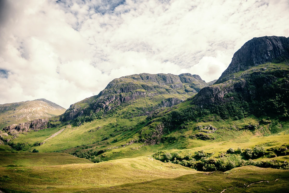
Quick Comparison of Easy Winter Walks
| Walk | Distance | Time | Ascent | Difficulty | Parking | Dogs | Best for |
|---|---|---|---|---|---|---|---|
| Glencoe Lochan (Lochan Trail) | 1.6 km (1 mile) loop | ~30 min | Minimal | Easy | FLS car park, £1/hr or £3/day | Yes, under control | Families, buggies, reflections |
| Glencoe Lochan (combined trails) | 2.5 km | 1–1.5 hrs | 100 m | Easy–moderate (steep sections) | As above | Yes | Views over Loch Leven |
| NTS Visitor Centre woodland trails | 300 m to just over 1 mile | ~30 min | Low | Easy (Yellow is all-access) | NTS car park £4 (members free) | Yes, under control | Rainy days, toilets and café |
| Greenway to An Torr / Signal Rock | 5 km return (7 km with Signal Rock) | ~2 hrs | 72 m (115 m with Signal Rock) | Easy–moderate | NTS car park £4 | Yes, under control | Views into the glen, traffic-free |
| An Torr trails (from An Torr car park) | ¾ mile to 1¼ miles | 25 min–1 hr | Low–moderate | Easy | An Torr car park (A82) | Yes, under control | Woodland and history |
| Ballachulish quarry and Loch Leven | 2 km | 45 min–1 hr | 17 m | Very easy | Ballachulish visitor centre car park | Yes | Flat, lochside, short days |
| Brecklet Trail, Ballachulish | 3 km | 1–1.5 hrs | Moderate climb | Easy–moderate | As above | Yes | Viewpoints over Loch Leven |
| Grey Mare's Tail, Kinlochleven | 3.5 km full loop | 1.5–2.5 hrs | 185 m | Moderate; the waterfall spur is easier | Car park by St Paul's Church | Yes; keep them close on steep bits | A big waterfall after rain |
| Inchree Falls, Onich | 5 km | 1.5–2.5 hrs | 278 m | Moderate | Glenrigh FLS car park (charge) | Yes | Waterfalls and forest |
| Glencoe ski area chairlift | Lift ride | — | — | Non-walkers | Resort car park | Dogs allowed on the lift | Snow views without the climb |
The figures come from Forestry and Land Scotland (FLS), the National Trust for Scotland and Walkhighlands. Times are for summer conditions, so allow longer in winter.
1. Glencoe Lochan Trails
This is the safest walk in the glen, and the prettiest. Lord Strathcona planted the woodland around the lochan in the 1890s for his homesick Canadian wife. On a still winter morning the lochan reflects the Pap of Glencoe almost perfectly.
- The three FLS trails: the Lochan Trail is 1 mile (1.6 km); allow half an hour. It has a wide, firm, smooth surface, is generally flat with short gentle gradients and rest points, and is the one for buggies, wheelchairs and anyone wary of slipping. The Woodland Trail is 1 mile; allow three-quarters of an hour. It is firm, with rough, rocky and rooty sections and short steep bits, and it can be muddy after rain. The Mountain Trail is 1 mile; allow three-quarters of an hour. Expect loose gravel, uneven stone steps and long, very steep gradients.
- Combined loop: Walkhighlands links the trails into a 2.5 km walk of 1 to 1.5 hours with 100 m of ascent.
- Parking: £1 for up to an hour, £3 all day, and Blue Badge holders park free. Pay by card or RingGo. The tarred approach drive is not suitable for motorhomes. The car park is just east of Glencoe village, over the River Coe bridge (PH49 4HT).
- Toilets: none on site. FLS says the nearest public toilets, cafés and shops are in Glencoe village.
- Dogs: popular with local dog walkers. There is no livestock on the trails, but deer may appear.
- In winter: the Lochan Trail rarely gets dangerous. The steep stone steps on the Mountain Trail are where ice and wet leaves catch people out, so on a frosty morning stick to the Lochan Trail or carry microspikes.
Trail colours differ between sources and the boards on site, so follow the trailhead board for the route you have picked.
Other Experiences You Might Enjoy
If you would rather see more of the Scottish Highlands than one glen, guided day tours from Glasgow, Edinburgh and Fort William run through the winter to Glencoe, Rannoch Moor, Loch Ness, the Glenfinnan Viaduct and Ben Nevis, many with short walks at the stops. The suggestions below are matched automatically to these destinations and experiences.
2. NTS Visitor Centre Woodland Trails, the Greenway and An Torr / Signal Rock
The Glencoe Visitor Centre is the best base on a grim day, with toilets, the Highland Coo Café, exhibitions and rangers who can tell you about current conditions.
- Woodland trails (NTS): the Blue Trail is just over 1 mile, the Black Trail half a mile and the Yellow Trail 300 m. The Yellow Trail is all-access. NTS allows about 30 minutes and rates them easy.
- The Greenway into the glen: the new traffic-free Greenway runs from the Visitor Centre, passes under the A82 and reaches the An Torr car park. NTS gives 3 miles (5 km) return with 72 m of ascent, or 4½ miles (7 km) with 115 m if you add Signal Rock. Allow about 2 hours. The main route suits wheelchairs and buggies; the Signal Rock extension doesn't.
- An Torr trails (NTS): these start from the An Torr / Signal Rock car park on the A82, about 1 km west of the Clachaig Inn turn-off. The Blue Trail is 1¼ miles (45 min), the Black Trail just over 1 mile (1 hr) and the Yellow Trail ¾ mile (25 min). Expect steps and moderate slopes. Tall trees block the view from Signal Rock, but the River Coe bridge has a fine view up the glen.
- Parking: NTS charges £4 per car at the Visitor Centre, and members park free. Check the signs at the An Torr car park on arrival, as we could not confirm whether it charges.
- Opening hours: NTS lists 09.30–16.00 daily from 26 October to 23 December. The centre is closed 24–26 December and 31 December–1 January; check the NTS website for hours from 2 January 2027.
- Dogs: welcome, but NTS asks that they stay on a lead or come back immediately when called, to protect wildlife.
3. Glencoe Village to the Visitor Centre
NTS describes the walk from the Visitor Centre to Glencoe village as “just over a mile” through woodland. It is part of the path network NTS and FLS upgraded under the Greenway project, and it lets you leave the car in the village, walk to the centre and add the woodland trails. Expect a firm path that can be wet or leafy. In past winters, sections have closed temporarily for path works, so watch for signs.
4. Grey Mare's Tail, Kinlochleven
This is one of the most impressive waterfalls in the area. The Allt Coire nam Ba drops almost 50 m in a single leap, and the falls look their best after winter rain.
- Start: the car park beside St Paul's Church, signed “Grey Mare's Tail” from the main road in Kinlochleven.
- The easy option: a gravel path winds gently uphill to a footbridge, and the falls are a couple of hundred metres beyond.
- The full loop (Walkhighlands): 3.5 km, 1.5–2.5 hours and 185 m of ascent, continuing past the closed Mamore Lodge and back on the West Highland Way. After the falls the path climbs very steeply and is rough, rocky and eroded, and near the end there is a stream ford on stepping stones.
- Toilets: in Kinlochleven village, including the community toilets by the River Leven bridge.
- In winter: spray near the falls freezes. In a cold snap, enjoy the view from the main path and don't scramble closer. Skip the steep upper loop in icy conditions unless you have microspikes and the path is low-angled and well trodden that day.
5. The Glen Floor: Three Sisters Viewpoint and Loch Achtriochtan
The big car park halfway up the glen (grid reference NN170569) is the classic Three Sisters viewpoint and the start of the Lost Valley walk. From here a short path drops to the old road along the glen floor, an easy out-and-back stroll with huge views. Walk as far as you like and turn round. There is no official distance for a Loch Achtriochtan circuit, so treat this as a stroll of your own length, not a set route.
- Facilities: no toilets at the roadside car parks. Use the Visitor Centre, or the Clachaig Inn as a customer.
- In winter: keep to the old road and obvious paths. Don't cross the River Coe, and keep children well back from the gorge.
6. Glen Etive Riverside Wanders
Glen Etive is a single-track dead end off the A82, with river pools and big mountain views. Low-level wandering by the river is lovely on a calm, dry day.
- Parking: never park in passing places, gateways or on soft verges. The Scottish Outdoor Access Code asks drivers not to block field entrances, not to make it hard for others to use a road or track, to avoid damaging verges, and to use a car park if there is one nearby. NTS has been enlarging lay-bys, including at the “Skyfall” viewpoint and Triple Falls, because bad parking was blocking traffic.
- New for 2026: according to a Highland Council news release of 14 May 2026, the Lochaber Area Committee approved mandatory parking charges at Glen Etive Road End on 11 May 2026. The order also bans overnight parking between 10pm and 8am, and the council hoped charging would begin in June or July 2026. Check the signs for the tariff when you arrive.
- In winter: the road is narrow, can be icy and has no facilities. Riverside rocks are treacherous when wet or frozen.
7. More Low-Level Walks Nearby
- Ballachulish slate quarries and Loch Leven: Walkhighlands calls it an “extremely easy walk, mostly flat terrain on prepared paths”: 2 km, 45 minutes to an hour, 17 m of ascent. Start from the visitor centre car park in Ballachulish, which has public toilets. It is the best pick for the shortest December days.
- Brecklet Trail: this FLS trail starts from the same quarry and climbs above it for views over Loch Leven: 3 km, 1 to 1.5 hours. It is steeper than the quarry loop.
- Inchree Falls, Onich: 5 km, 1.5–2.5 hours and 278 m of ascent on waymarked paths and tracks, from the Glenrigh FLS car park (charge). Expect a fair amount of uphill and a series of waterfalls.
- Kinlochleven–Mamore Lodge track: the tarmac road down from Mamore Lodge is part of the Grey Mare's Tail loop. It is easy underfoot but exposed to the wind.
- Steall gorge, Glen Nevis: not an easy winter walk. The rocky path runs above steep drops into the gorge, and several guides warn that it is dangerous when wet or icy. Don't attempt the wire bridge in winter.
- Glencoe Mountain Resort chairlift: for non-walkers, this is the easy way into the snow. The resort says the chairlift runs throughout the year, weather permitting, and its 2025/26 winter price list gave £20 adult, £15 junior and £65 family for the chairlift only. Dogs are allowed on the lift, and the Eagles Rest viewpoint is right off the chair. High winds or a power cut can stop the lift, so check the resort's snow report before you drive up. Our Glencoe Mountain Resort guide has the 2026–27 chairlift ticket prices and sledging.
Step-Up Walks (Only in Good Conditions)
The Lost Valley (Coire Gabhail)
- Stats (Walkhighlands): 4 km return, 2–3 hours in summer conditions, 335 m of ascent, grade 3 of 5. Terrain: “steep and rocky path with some mild scrambling; great care needed.”
- What's involved: from the Three Sisters car park you go down a stairway to a bridge over the River Coe gorge. Beyond it the path is rocky, with a handrail in places. Higher up you cross the burn on stepping stones, then climb a polished rocky rake with a steep drop on one side. Walkhighlands warns that “the steep ground crossed on the way should not be underestimated”, and its route notes record fatalities where people fell into the gorge.
- In winter: the stepping stones can be underwater or glazed with ice, and the rake becomes dangerous when it is verglassed or snow-covered. Microspikes don't turn it into safe terrain.
- Turn back if: the stepping stones are submerged or iced, the rake has any ice or snow, the SAIS or MWIS forecast mentions snow or a freezing level at valley height, or you won't be back at the car by about 2pm in December.
The Devil's Staircase from Altnafeadh
- Stats: it climbs from Altnafeadh, at around 270 m, to the highest point of the West Highland Way at 550 m. Scotland's Best Walks With Children gives the walk to the top and back as 3.6 km with 250 m of ascent, and says it should take “well under one hour” to reach the top. AllTrails gives 5.1 km out and back with 400 m of gain.
- In winter: at 550 m the top often holds snow and hard ice when the glen is clear, and the pass is very exposed to wind. In good conditions it is a fine half-day; in wintry ones it is a hill walk that needs proper kit and skills.
- Turn back if: the path is iced or snow-covered beyond gentle angles, the wind is strong, cloud is down on the pass, or daylight is running short. Parking at Altnafeadh is limited roadside parking by the A82, with no toilets.
Microspikes vs Crampons
Mountaineering Scotland is clear that the two are not interchangeable. It describes microspikes as designed for “icy paths and tracks with low-angle inclines, typically 15–20 degrees”, and crampons as the tool for steeper, technical terrain “where a slip could result in serious consequences.” Its Mountain Safety Advisor, Ross Cadie, warns that treating them as interchangeable “can put people at serious risk in the mountains in winter.”
What that means for you:
- Microspikes help on frozen forest tracks, icy car parks, the Lochan and Greenway paths after a hard frost, and compacted snow on gentle paths.
- Crampons, plus an ice axe and the skills to use them, are needed on steep snow or ice, in gullies and corries, and on any slope where a slip wouldn't stop. That includes the Lost Valley rake and the upper Devil's Staircase in full winter conditions.
- If you'd need crampons, it isn't an easy walk. Choose a lower route or book a guide.
What to bring for these walks, from microspikes to a head torch, is in our Glencoe winter packing list.
Winter Walking Safety in Glencoe
- Daylight: for Fort William, sunrise-sunset.org gives 21 December 2026 a daylight length of 6 hours 45 minutes, with the earliest sunset at 3:39pm on 14 December and the latest sunrise at 8:57am on 28 December. By 31 January the day runs from roughly 08:22 to 16:47. In December, plan to finish by about 2pm, and always carry a head torch.
- Forecasts: check the MWIS West Highlands forecast for wind, wind chill and the freezing level. For anything above the glen floor, also check SAIS Glencoe. The Scottish Avalanche Information Service usually starts its full daily forecasts in mid-December, sometimes earlier in Lochaber if winter arrives early, and it had not published a 2026–27 start date by late October.
- Kit: waterproof jacket and trousers, warm layers, a hat and gloves, sturdy boots, food, a hot drink and a charged phone. Carry a paper map, such as OS Explorer 384 for Glen Coe, or an offline map app as a backup. Our winter packing list for Glencoe has the full checklist.
- Turnaround times: set one before you start and stick to it. Turning back early is normal in a Scottish winter, not a failure.
- Mountain rescue: Glencoe Mountain Rescue Team is made up of unpaid volunteers on call around the clock. In an emergency, call 999 and ask for Police, then Mountain Rescue.
- Dogs and deer: the Scottish Outdoor Access Code asks you to keep dogs on a short lead or close at heel in fields with farm animals, and never to let a dog worry livestock. Red deer hind stalking runs from 21 October to 15 February, and deer control in forests often happens around dawn and dusk. Follow any signs, and if in doubt, use a lead.
Guided Walks and Winter Skills
Without your own winter experience, a guide is the safest way to see more than the glen floor.
- NTS Glencoe ranger events are listed on the Glencoe National Nature Reserve Eventbrite page. Check it for winter dates.
- Ocean Vertical lists a Winter Hillwalking Experience from £105 (November to April) and a Glen Coe Winter Ascent at £145pp in groups of up to six.
- The Mountaineering Company lists two-day West Coast Winter Walking dates in Glencoe on 30 January, 18 February and 6 March 2027. These need some previous ice-axe and crampon use.
- Leading Edge runs three-day winter skills courses in Glencoe at £350, non-residential, with a ratio of one guide to four.
If you want a gentle guided day instead of a skills course, the small-group Glencoe walking day from Glasgow includes the Lochan walk and needs no winter kit. For tours that stay on the coach, see Glencoe day tours in winter.
Frequently Asked Questions
Plan the Rest of Your Winter Trip
Once you know where you'll walk, these are the next decisions.
- What will you need?
Glencoe winter packing list › - Where will you sleep?
Where to stay in Glencoe in winter › - How will you get there?
Driving the A82 to Glencoe in winter › - What else is open?
Is Glencoe open in winter? ›
Rather Walk the Glen With a Guide?
A small-group day from Glasgow takes in the Three Sisters, the Visitor Centre and a Glencoe Lochan walk, with the A82 driving done for you.